

Map Type
Socio-Economics
Data Source
U.S. Census Bureau
Data Source Date
2010
Creation Date
2014
Preview
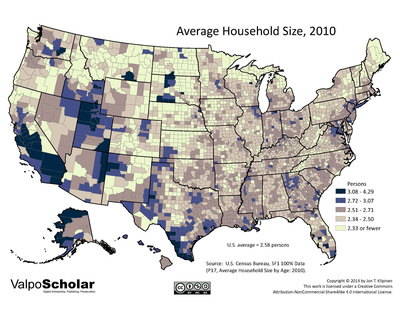
Description
County-level map of the average household size in the United States in 2010
Recommended Citation
Kilpinen, Jon T., 2014. "Average Household Size, 2010." United States Map Gallery. Map 12.09. http://scholar.valpo.edu/usmaps/104
12.09_hshld_size_2010.pdf (2579 kB)
PDF full version
PDF full version
Keywords
U.S. Census, United States, choropleth, geography, map, ValpoScholar, population, household size